0

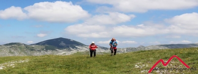
Veliko polje-Hrasnički stan (15.3.2021)

Polazna tačka: Veliko polje (Monti), Igman

Završna tačka: Hrasnički stan

Upute za dolazak do polazne tačke: Magistralnim putem M18 do Krupca gdje odmah iza kamenoloma treba skrenuti desno na Regionalni put R442a prema Bjelašnici i Igmanu. Na raskršću kod policije skrenuti desno na Igman i i auto parkirati na proširenju iznad Velikog polja

Opšte upute: Polazak je sa Igmana, sa ceste iznad Velikog polja. Orijentacija nije zahtjevna jer se cijelo vrijeme ide vrlo dobrim makadamskim putem, koji vodi do Ratne džamije na Igmanu, pa dalje sve do Hrasničkog stana. Postoje planinarske staze koje skraćuju put ali smo ih izbjegavali zbog blata. Povratak je istim putem

Oprema: Standardna planinarska oprema prilagođena vremenskim uslovima.

Sigurnosne informacije: Staza nije tehnički zahtjevna i nema opasnosti od mina.

Tehnička zahtjevnost ture: Kondiciona zahtjevnost ture:


Pročitajte reportažu sa ove ture

Category: Igman 4 years ago
Midhat
Created 4 years ago
Midhat

Like it on Facebook, Tweet it or share this track on other bookmarking websites.

Rate this track:

Rating: 5.00

Min Elevation
1229 m
Max Speed
5.4 km/hr
Max Elevation
1395 m
Average Speed
0 km/hr
Total Elevation Gain
486 m
Total Distance
14.66 km
Total Elevation Loss
487 m
Total Time
15d 0h 18m 04s
# Elevation Distance
1 Hrasnički stan2 1315 m 0 km
2 Ratna džamija 1340 m 1.45 km
3 Veliko polje 1230 m 2.43 km
Values not available in the file may shown as 0.

This track was downloaded 60 time(s).

Please register/login to download this track.
Please wait while loading suggestions..
openstreetmap
400px
https://{s}.tile.opentopomap.org/{z}/{x}/{y}.png
© OpenStreetMap contributors
Distance: {0} {2} Elevation: {1}
Distance: {0} {2} Speed: {1}
Distance: {0} {2} Heart Rate: {1}
Distance: {0} {2} Cadence: {1}
https://planinarenje.ba/media/com_gpstools/markers/02marker.png
https://planinarenje.ba/media/com_gpstools/markers/default.png
#0000FF
#0000FF
1
2
100
google.maps.MapTypeId.SATELLITE
1
0
1
0
0
0
0
google.maps.ZoomControlStyle.DEFAULT
google.maps.MapTypeControlStyle.HORIZONTAL_BAR
Distance
Elevation
Speed
Heart Rate
km
kmph
m
km
Miles
m
ft
mile/hr
ft/sec
km/hr
m/s
/index.php?option=com_gpstools&task=rating.rate&id=579&format=json
Save
Cookies user preferences
We use cookies to ensure you to get the best experience on our website. If you decline the use of cookies, this website may not function as expected.
Accept all
Decline all
Read more
Cookies
Cookies
Cookies
Cookies
Accept
Decline
Analytics
Tools used to analyze the data to measure the effectiveness of a website and to understand how it works.
Google Analytics
Accept
Decline
Marketing
Set of techniques which have for object the commercial strategy and in particular the market study.
DoubleClick/Google Marketing
Accept
Decline